EUROSEISTEST
DATABASE
Facilities
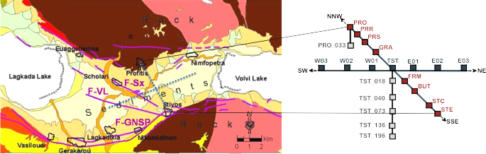
- The permanent accelerometric network of 21 digital 3-component stations
- A model structure of a 1-degree-of-freedom oscillator at the centre of the valley (EuroProteas)
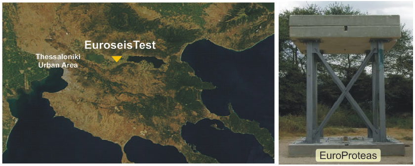
Figure 1: Location of the EUROSEISTEST (left) and photo of the EuroProteas model (right).
The
EUROSEISTEST accelerometric network
has been in operation since 1993, under the responsibility of the Research Unit of Soil Dynamics and Geotechnical Earthquake Engineering (SDGEE) of the Aristotle University of Thessaloniki with the support of the Institute of Engineering Seismology and Earthquake Engineering
(ITSAK). The network initiated as a N-S array of accelerometers, vertical to
the long axis of the Mygdonia graben and two downhole arrays with subsurface
instruments at the center of the valley and the northern edge of the basin. Initial stations installations involved
mostly 12- and 16-bits accelerographs and data from this first era are of poor
quality and lack absolute time. In the following years stations
were gradually upgraded with modern recording instruments (mostly 18-bits)
and Global Positioning Systems (GPS). A major upgrade and extension of the network
was achieved in 2003. All stations were equipped with GPS and the array has been enriched with accelerometric stations in the east-west direction.
At present, EUROSEISTEST network consists of 21 high-resolution, three-component accelerographs, fourteen of which are installed at the ground surface or within small structures and the remaining six in boreholes, at various depths. The network, in its present form, is shown in Figure 2.